


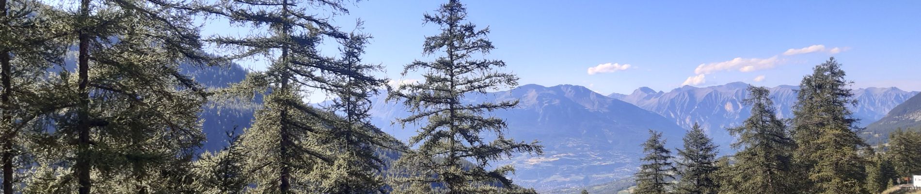
lac sainte marguerite montee par la piste redescente par la cabane d eyssalette

stef789
User GUIDE
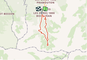

Length
10 km

Max alt
2243 m

Uphill gradient
588 m
Km-Effort
17.8 km

Min alt
1660 m

Downhill gradient
586 m
Boucle
Yes
Creation date :
2021-08-06 10:35:39.728
Updated on :
2021-08-06 16:21:38.084
3h43
Difficulty : Medium

FREE GPS app for hiking
 SityTrail
IGN / Geographical institutes
SityTrail Plus
The world is yours!
About
Trail Walking of 10 km to be discovered at Provence-Alpes-Côte d'Azur, Hautes-Alpes, Les Orres. This trail is proposed by stef789.
Photos


Positioning
Country:
France
Region :
Provence-Alpes-Côte d'Azur
Department/Province :
Hautes-Alpes
Municipality :
Les Orres
Location:
Unknown
Start:(Dec)
Start:(UTM)
305193 ; 4928631 (32T) N.
Comments